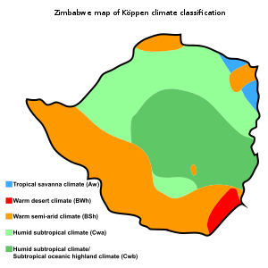
Zimbabwe can be subdivided into what are known as ecological regions (better still, agro-ecological regions). If you have not heard those terms then maybe you have heard of natural regions. Knowing these regions is highly important especially to farmers. 3 core characteristic areas inform those subdivisions. The 3 are the quality of the soil, rainfall patterns, and type of vegetation – the attributes are of course more than those 3. Zimbabwe typically has 5 natural farming regions. Even though rainfall is erratic and climate has been changing it is still important to know these regions. The focus of this article will be to discuss them so that you know what characterises them.
Natural Region I
Overview
This region occupies an area of 7000 square kilometres. Region I is entirely found in and occupies part of Manicaland province. This means it constitutes 2 per cent of the total surface area of Zimbabwe. Annual rainfall of more than 1000 millimetres is typical in Region I. The superior thing about rainfall in this region is that it can occur in any or all the months.
Agricultural Attributes
Region I is for specialized and diversified farming. Intensive farming and forestry are the two major activities in this region. Special mentions are fruit production and livestock production. Due to the often abundant and reliable supply of rainfall, the aforementioned areas can thrive quite well.
Natural Region II
Overview
Region II is 58600 square kilometres in area which is 15 per cent of Zimbabwe. Anything from 700 millimetres to just over 1000 millimetres of rainfall is the average annually. For Region II rainfall tends to occur only during the hot season. It is worth mentioning that this region is further broken down into two categories namely, Region IIA and Region IIB. Region IIA occupies part of Mashonaland West, part of Mashonaland Central, part of Mashonaland East and the whole of Harare province. Region IIB occupies parts of the following provinces namely, Manicaland, Mashonaland East, Mashonaland West, and Mashonaland Central.
Agricultural Attributes
Intensive farming is the preserve of Region II. I would say that Region II is the most diversified natural farming region in Zimbabwe. There are so many agricultural activities that can be practised in this region. Common examples are maize (including seed maize), cotton, and tobacco farming. Horticulture and livestock production are also commonly found in this region. Another notable crop production activity in Region II is coffee farming.
Natural Region III
Overview
The region covers an area of 72900 square kilometres. The percentage area Region III covers is 18 per cent. Region III is found in parts of the following provinces, Midlands, Mashonaland East, Mashonaland West, Manicaland, Masvingo, and Matabeleland North. The annual rainfall average lies between 500 millimetres and 700 millimetres. Dry spells can be encountered; the rainfall is erratic but heavy when it occurs.
Agricultural Attributes
Region III is mainly for semi-intensive farming. This region is mainly characterised by two farming activities namely, beef production and maize farming. It is, however, vital to know that irrigation may be necessary due to the occasional dry spells.
Natural Region IV
Overview
Region IV is the biggest of all the regions with an area of 147800 square kilometres. That area is 38 per cent of Zimbabwe. This region is found in and as part of all the provinces except for Harare. It is also worth noting that the whole of Bulawayo province in Region IV. Rainfall is usually 450 millimetres to 600 millimetres per year.
Agricultural Attributes
Just like Region III, this region is for semi-intensive farming. For this region, it is usually best to grow small grains (maize can also cut it). This premised on how arid the region generally is.
Natural Region V
Overview
Region V is the second largest natural farming region in Zimbabwe. It covers an area of 104400 square kilometres which is 27 per cent of Zimbabwe. The greatest portion of Masvingo province is Region V. Half of Matabeleland South is Region V. Region V is also part of Matabeleland North, part of Midlands, part of Mashonaland West, and part of Manicaland. Rainfall, per year, never gets to reach 500 millimetres.
Agricultural Attributes
Region V is for extensive farming. Just like Region IV small grains and maize are best suited to this region. The basis is the same which is the prevalence of dry spells.
This is a subject area that most of us might recall from our primary and secondary education. I thought it would be best to help you revisit this important area – particularly for farmers. Most Zimbabwean farmers still rely on natural weather or climatic conditions. It is sad because most farmers cannot afford to employ specialized farming approaches such as greenhouse farming, vertical farming, and the like. Thus they are left with no choice but to rely on natural conditions. It is with that in mind that it is pertinent for one to know these natural farming regions. This will greatly inform making the right decisions on what and where to farm.


what does hemp cbd oil do